Road safety on the E16 in Vaksdal

Cautus Geo secures the E16 in Vaksdal. A new radar system is in place. It ensures automatic road closure and reopening.
15. December 2023
Written by Rino Andersen
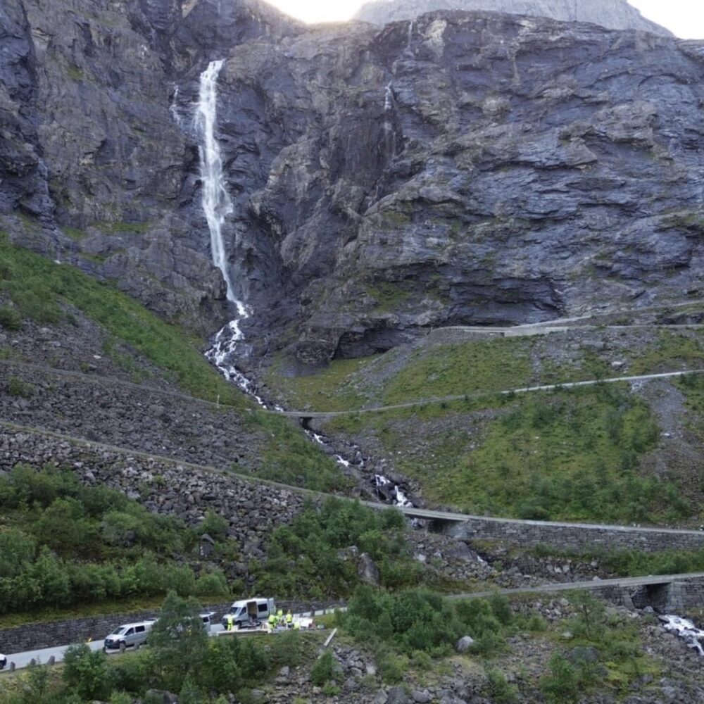
E16 past Bogelia in Vaksdal, secured by Cautus Geo. A new radar system has been established. Traffic is automatically stopped if earth, rock or snow masses threaten the road.
The Norwegian Public Roads Administration has commissioned Cautus Geo to secure the Bogelia landslide point on the E16 motorway between Bergen and Voss for up to 12 years. The latest and most modern radar system has been established to monitor the mountainside located in Vaksdal.
The heavily trafficked European motorway between Bergen and Voss is part of the main route between eastern and western Norway. Almost 6,000 vehicles pass Bogelia every day. The Norwegian Public Roads Administration, in collaboration with several suppliers, has been monitoring the route with radar since 2017. Last summer, the service was put out to tender again. This winter, Cautus Geo has taken over the assignment.
- "We have established a new and modern system. It provides more and better data, more analysis and automatic notification, closure and reopening of the road," says Lars Krangnes of Cautus Geo.
33 billion
33 billion is the price tag for securing all avalanche points with high and medium avalanche factor categories on the national road network, according to updated lists from 2023. NAF has looked at the price of securing the ten most vulnerable national and county roads. It totalled NOK 14.2 billion. Many of the roads are located in Vestland county, but there are also major needs for landslide protection in Nordland, Troms, Finnmark and Møre og Romsdal counties.
- Tunnels are often the most desirable and safest option. The downside is that they are expensive and take a long time to establish. At the same time, we can secure significantly more than today with more use of modern technology," says Krangnes.
12 roads in Norway are secured with radar or geophones. Cautus Geo has set up security and alerts with automatic road closures on seven of these stretches.
- The potential is greater. In recent years, we have also developed technology that can monitor, warn and close roads in the event of rockfalls. Technological protection is at a whole new level compared to the technology we had a few years ago," says Krangnes.
Slides per year
Rockslides also occur on the European road past Bogelia. The avalanche report shows that there are avalanches with snow, stones or mud every year. In 2015, large landslides swept across the road twice in May.
- The route will be monitored automatically and continuously throughout the year. It's about more than avalanches. Flood avalanches, landslides and rockslides can also occur as a result of large amounts of precipitation and flood-like situations, according to the avalanche report published by the Norwegian Public Roads Administration earlier this year.
The new system with the latest technology has been installed.
- Signals from avalanche monitoring are sent to signs, barriers and lighting systems operated by the Norwegian Public Roads Administration along the E16 motorway. These handle road closures and openings. "We also have access to the Cautus Web data management system," says Sten Ove Stenhjem, Construction Manager at the Norwegian Public Roads Administration.
One kilometre
The stretch past Bogelia is almost a kilometre long. The landslide is triggered 960 metres above the road surface. There is a relatively slack mountain section. The landslides follow various streams down the mountainside. In height metres, it is 600 metres from the point where the landslide is triggered down to the road surface. The avalanche masses will take from 45 to 90 seconds from top to bottom, according to the avalanche report.
- "Avalanche warnings on the route are important. "If a landslide is triggered and the roadway is closed for a long period of time, road users will have to take a long, narrow bypass road that is also prone to landslides," says geologist Njål Farestveit. He is the technical coordinator for landslides at the Norwegian Public Roads Administration.
- The road is closed as soon as a landslide is triggered a few hundred metres above the road surface. If the landslide masses do not reach the road, which can often occur on this stretch, traffic will be reopened automatically. This will be detected by the system. Traffic can then reopen after a short time," says Krangnes.
The radar is located at Olsneset in Osterøy. It covers the stretch between Bogetunnelen and Kjennestunnelen in Vaksdal municipality.
Equipment included in the monitoring:
- Radar covers all avalanche paths on the route.
- Cameras document landslides.
- Cautus Web analyses and documents.
- Signs, barriers and lighting systems.